Tuesday, October 17, 2017

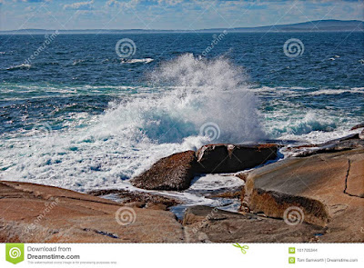
Waves Crashing On The Rocks At Peggy's Cove, Nova Scotia

peggys cove nova scotia dreamstime

Photo Details


The above image was taken in September, 2017 at Peggy's Cove, Nova Scotia. The photo is a 1/800th of a second exposure at f5.6 and iso125. The crashing waves were taken from a safe distance away with a long lens. This location is notorious for its unpredictable waves that can become very large, very fast. That cold ocean water crashing on those rocks pretty much spells doom for those who wander to close.


Peggy's Cove, Nova Scotia


Peggy's Cove is located just a short drive from Halifax, Nova Scotia on the shores of the Atlantic Ocean. The quaint fishing village is known for its historic and picturesque lighthouse as well as the photogenic waves crashing on the rocks. The fishing village has retained its historic charm with residents still involved in traditional lobster fishing, as well as the tourism trade.

As mentioned, this is a deceptively dangerous place. There are no barriers and visitors are allowed to roam freely on the rocks beyond the lighthouse. However, the waves can come out of nowhere and swamp seemingly safe locations with several feet of fast moving water. There formerly was a patrol that warned and educated people on the dangers but it was pulled because of safely reasons.

If the rocks are black, stay away. That is the warning that is posted in numerous locations. If the rocks are black, that means water has been up to and will cover that location again at any time. A startling picture from an August CBC article shows one elderly tourist with her feet in the water. Not only could she get swept away at any time, she was wearing clothing that would sink her to the bottom like a rock.

Check out our main article on It's About Travelling: Peggy's Cove, Nova Scotia.
Sunday, October 15, 2017

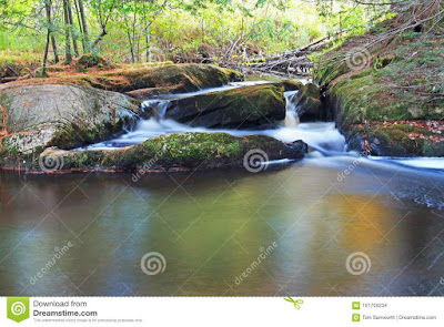
Potts Creek in Bracebridge, Ontario Canada (Long Exposure Water Blur)

potts falls long exposure bracebridge ontario


Photo Details


This image was taken on Potts Creek, just above the main Potts Falls. The heavy overhead cover allowed a 13 second exposure with just a polarizer filter (f13, iso100). Leaving the tripod in the car, for some odd reason, the photo was taken with the camera resting firmly on the ledge of the walking bridge.


Potts Falls


An awesome, easy to get to and free to visit location, Potts Falls is part of a small park that serves as more of a rest stop / picnic area for travelers on the busy Highway 11. My guess is, many visitors don't even know there are waterfalls in the very near vicinity.

Potts Falls consists of a few drops on Potts Creek before it empties into the North Branch of the Muskoka River. Just upstream on the Muskoka is the much larger and much more imposing Muskoka High Falls. Potts Falls is calmer and has more of a fantasy world look to it.

The site is located just off Highway 11 at the exit for Cedar Lane and Highway 117. The small waterfall is accessed by a short trail off the main park road. Despite being just 20-30 feet from the road, the small waterfall cannot be seen until you pass through the thick undergrowth.  The large waterfall is located at the furthest point in the park and has a walking bridge crossing just above the crest.


Wednesday, September 13, 2017

London, Ontario Skyline With Freight Trains

Growing up in the west end of London, Ontario, I seldom strayed to the east side, except for hockey and baseball games. In the past few years, after now spending half my nearly half century life out of London, I've discovered this place to keep two train crazy kids entertained.

The rail yards, and the whole rail system passing through this city, are a pain in the ass to the majority of residents. However, for someone looking to actually enjoy this impossibly large form of transportation, the rail yards in London are perfect.

Tucked in behind a shopping centre at Highbury and Trafalgar, you have a barrier free, close-up view of the action on the tracks. It's not exclusive to freight trains. You will see the odd VIA Rail passenger train pass by, as well.

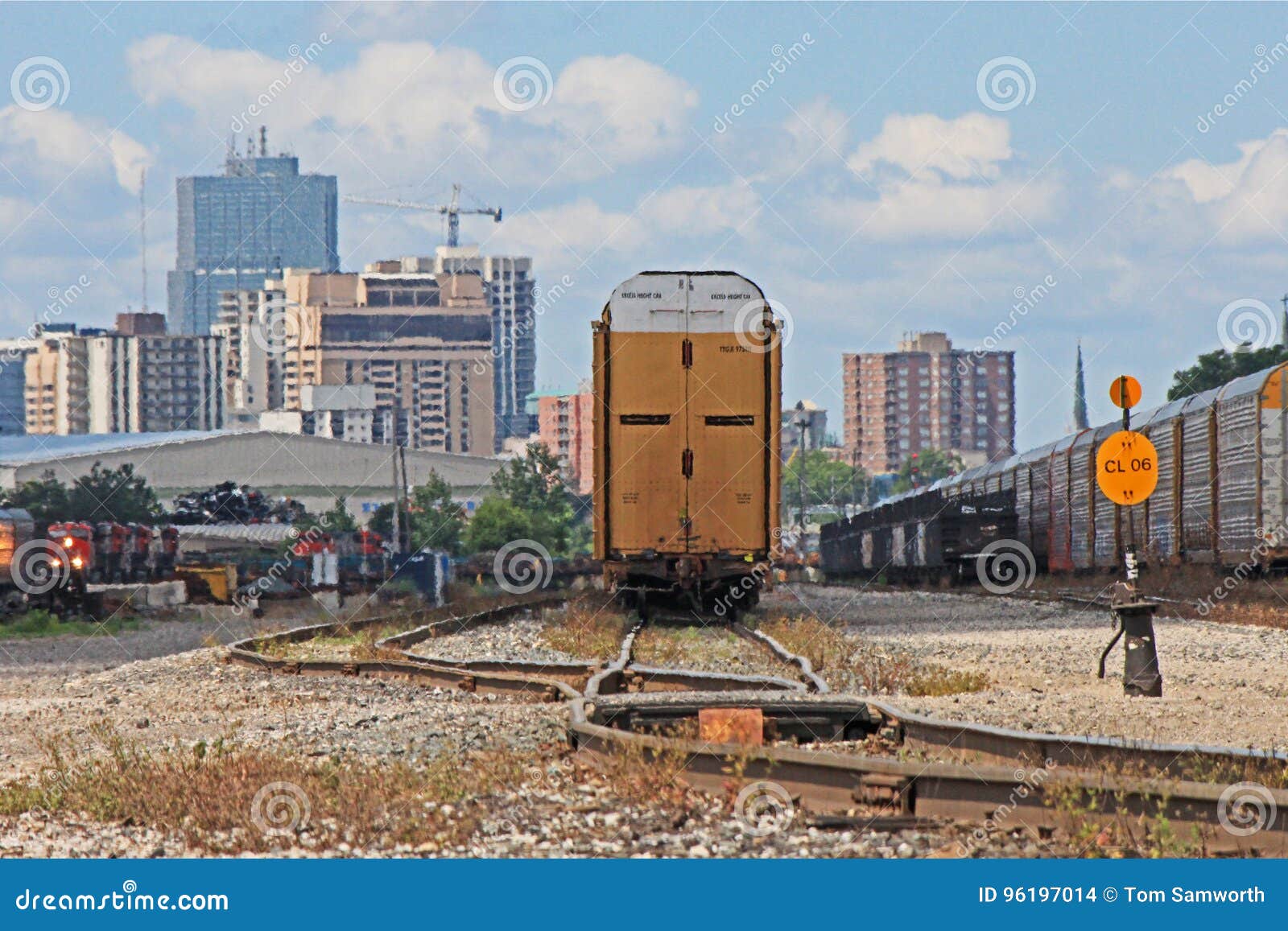
London, Ontario Rail Yards With Downtown Skyline In Background

london ontario railyards and downtown skyline

The image above was taken in July, 2017 and is available for download at Dreamstime. Ideally, the best time for photography here would be with the early morning light making the train cars and the skyline behind glow.

London, Ontario

London, Ontario is a city of nearly 400,000 (metro population nearly 500,000) located directly between Toronto, Ontario and Detroit, Michigan. London was settled as a village in 1826 and was incorporated as a city in 1855. The city is home to the University of Western Ontario and Fanshawe College.

London, Ontario Downtown Video


The video below was taken in June, 2017 and weaves around the streets of downtown London, Ontario. If you like what you see, please give it a 'Thumb's Up' in YouTube. If you love what you see, please share with friends!

Tuesday, September 12, 2017

Crisp and Clean Canadian Shield Waterfall

The long, rugged waterfalls of the Canadian Shield are a photographer's dream. Typically with one of two main drops, the stereotypical cascade in Northern Ontario will have several smaller drops over a run of up to half a kilometre's distance. Onaping High Falls is just such a waterfall. Located northeast of the main city of Sudbury, Ontario, the waterfall is located just off highway 144, the road that will take you north to Timmins.


onaping falls sudbury ontario canada

Onaping High Falls


This waterfall is highlighted by the dramatic final drop of the Onaping River before it enters calmer waters. The river takes a 90 degree turn after the main waterfall, creating a bit of a whirlpool effect. However, what's above the main waterfall is actually quite a bit more photogenic.


First off, Onaping High Falls is free to visit. The parking lot is located just off highway 144 and is more advertised as a rest area with washrooms than a spectacular occurrence of nature. There is a viewing platform off the parking lot that will give you a clear shot of the main waterfall. What it doesn't show you from that point is what's lying just upstream. Countless visitors stop and see the main falls and miss out on the beauty beyond.

A trail runs from the parking lot to the base of the main falls then takes you up the rocks to the top. Along the way, there are several smaller drops full of rushing, clear and clean water. At the top, the trail crosses the river via a foot bridge. On the other side, a looping trail takes you through the wooded area.

The unfortunate thing, as with much of our accessible natural environment, is that folks still seem to have the urge to visit with a can of spray paint in their pocket. The graffiti ruins a good portion of the good angles and you have to really work around this visual pollution to get a clean shot.

The image above is available for download at Dreamstime. This is just one of several taken at this location. The photo was taken midday. Luckily, this landscape is beautiful, regardless of lighting conditions.

For a similar style of waterfall in the vicinity but with less flow and more twists and turns, take a look at Duchesnay Falls. This cascade is located in the opposite direction, just to the west of North Bay.